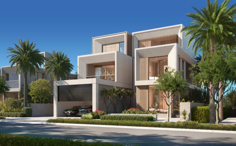
Peninsula Waterfront is a named locality within the Dubai Waterfront area and appears under the Hessyan First sub‑area in the site hierarchy. The placename indicates a waterfront setting inside the larger Dubai Waterfront master context; official listings and community summaries place it within that grouping. This page summarises available factual information about where Peninsula Waterfront sits in Dubai’s urban structure, how it connects to main destinations, what official property portals record about the area, and practical points for prospective buyers, renters and agents.
Peninsula Waterfront is identified as part of the Dubai Waterfront grouping, falling under Hessyan First in the hierarchical site path. The locality name defines its administrative or marketing identity within that chain: Dubai > Hessyan First > Dubai Waterfront > Peninsula Waterfront. Descriptions associated with the area emphasise its position in the wider Dubai Waterfront concept and its alignment with coastal or waterfront land planning within that master area. The official factfile for the location provides this placement and is used by property portals and community guides to group buildings, listings and maps that relate to the immediate surroundings.
Transport references for Peninsula Waterfront are given as road travel times to several key Dubai destinations and airport options. These travel times are expressed as rough drive durations and act as practical orientation points rather than precise commuting guarantees.
Public transit proximity is recorded by reference to the Dubai Metro Red Line. The nearest metro facility is identified as Red Line code R42 at an approximate distance of 19,350 metres from the locality; this distance is marked as non‑walkable in the factfile, indicating that regular pedestrian access to the metro is not practical from Peninsula Waterfront and that travel by car or shuttle would typically be required to reach the nearest Red Line station.
Travel times and transit notes cover driving estimates, maps and summaries for local attractions, parks, beaches, golf clubs and cinemas in the area. Those summaries and the interactive map are intended to help users visualise the relationship between Peninsula Waterfront and city focal points.
The collected factfile groups Peninsula Waterfront within the Dubai Waterfront master grouping and records how external portals host listings and community/building guides relevant to the area. Property portals that catalogue Dubai Waterfront locations typically present maps, nearest‑attractions summaries and agent listings linked to the locality. The available fact data does not enumerate specific developments or list onsite projects in the location record used here; instead, the locality is indexed as part of the wider Dubai Waterfront area for the purposes of listings and community information.
Users searching for development-level information for Peninsula Waterfront will commonly consult property portals and community guides that aggregate building pages, active listings and mapped amenities for Dubai Waterfront subareas. These resources aim to connect enquiries to the estate agents who advertise particular properties and to provide context on adjacent recreational and urban features; they do not act as a developer or as an intermediary in sales transactions beyond forwarding enquiries to the advertiser.
Peninsula Waterfront’s positioning inside the Dubai Waterfront context suggests it is relevant to audiences seeking a waterfront designation within a larger masterplan area. Practical considerations derived from the factfile indicate:
These points are neutral descriptors drawn from the locality’s transport orientation and the way it is presented within public property listings; they are intended to help buyers and renters decide whether to shortlist the area for further, site‑level inspection and agent contact.
How long is the drive to Dubai Mall from Peninsula Waterfront?
Drive times quoted in the locality record put Dubai Mall at about 47 minutes by car from Peninsula Waterfront. These figures are approximate and used for orientation.
Is Peninsula Waterfront served by the Dubai Metro?
The nearest recorded metro reference is the Red Line station identified as code R42 at roughly 19,350 metres distance. The factfile marks this distance as not walkable, so regular access to the metro would typically require vehicular transfer.
Which airports are closest by car?
The locality’s material lists Dubai International Airport (DXB) at about 54 minutes’ drive and the new Al Maktoum International Airport at about 38 minutes’ drive as practical road‑time references.
Where can I find current listings and more detailed community information?
Public property portals and community guides that index Dubai Waterfront locations host listings, maps and neighbourhood summaries relevant to Peninsula Waterfront. Enquiries sent about specific listings on those portals are forwarded to the advertising estate agents; the portals provide aggregated guides and maps to assist buyers, renters and agents in locating buildings and nearby features.
Machine-readable mirrors of this page: Markdown · JSON. Every field carries its origin.
How to cite:Peninsula Waterfront — Continental Club Property, 2026-08-30, https://continentalclub.ae/location/peninsula-waterfront/
Dubai market as a whole: prices, transactions and trends (DLD data) →
Nothing found. Try relaxing the filters.
Neighbouring areas and sub-communities to compare location and prices.