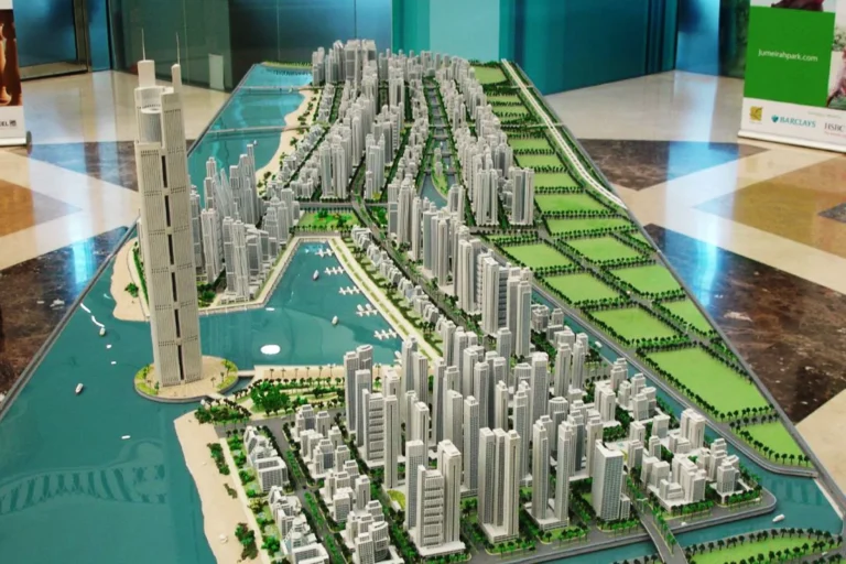
Al Ras Waterfront is listed as a locality within the Dubai Waterfront area, nested under the subdivision path Hessyan First > Dubai Waterfront > Al Ras Waterfront. The entry for the area on property portals provides a map-based orientation and pointers to nearby attractions and leisure assets that are commonly summarized for the wider Dubai Waterfront zone.
Al Ras Waterfront is recorded as part of the Dubai Waterfront grouping and appears in available location indexes as a named zone rather than as a single completed development. The official grouping path places it under Hessyan First and Dubai Waterfront, which situates it conceptually within that larger masterplan. The location description held in public property databases is accompanied by mapping tools that highlight the position of the zone and list the typical nearby categories of urban amenities such as attractions, parks, beaches, golf clubs and cinemas as reference points for prospective buyers and renters.
Public transport information attached to the Al Ras Waterfront record identifies the nearest metro reference as a Red Line station with code R42. The recorded straight-line distance to that metro point is 20,965 metres, which can be rounded to approximately 21 km; the entry marks this as not walkable from the recorded centre. This specific metro listing gives a single, standardised reference for rail access rather than a network of local rapid-transit stops.
Because official distance indicators in the location record are limited to the metro reference, any assessment of travel times or road connections should be based on on-site routing and current traffic conditions. The public record for the area is typically accompanied on property portals by interactive maps that allow users to measure road distances and to identify precise driving routes to central business districts and other points of interest.
The structured data associated with Al Ras Waterfront lists counts for projects on the site and projects nearby. Both values in the available record are zero, and no individual project entries are attached to the location record for display. The public-facing property portal entry that references Al Ras Waterfront is intended to act as a hub where agents may list specific properties when such listings become available; the portal also provides consolidated summaries of the kinds of attractions and amenities that tend to be important to prospective residents.
Where project-level or building-level information is published for other locations, the portal entries commonly include direct links to individual developments and to agents’ listings. For Al Ras Waterfront, those project and building links are not present in the indexed record at the time of extraction.
The location record for Al Ras Waterfront is maintained in a property-portal dataset that shows the position on a map and collates summaries of nearby attractions and leisure categories. The portal operates as an aggregator of agency listings: it hosts adverts submitted by a range of local estate agents and forwards enquiries to the agent responsible for a given advertisement. The portal is not a developer, estate agency, architect or construction contractor; its role is listing aggregation and community/area guidance rather than transaction execution. Visitors to the published entry are therefore presented with contact routes that connect them directly to the estate agents who advertise specific properties.
Given its registration as a named zone within the Dubai Waterfront framework, Al Ras Waterfront may be of interest to several user groups depending on the future availability of specific properties and the type of developments that may appear under that locality name. Typical user groups who consult a named-area index entry include:
Decisions about suitability should be made using up-to-date listings and site visits where possible. The location record functions as a starting point for that more detailed due diligence.
Q: How close is Al Ras Waterfront to the nearest metro?
A: The location record cites a Red Line station (code R42) at a straight-line distance of 20,965 metres, approximately 21 km; the entry marks this distance as not walkable from the reference point used in the map.
Q: Are there active development projects listed for Al Ras Waterfront?
A: The structured entry for this locality shows no projects recorded on-site and no projects recorded nearby in the indexed dataset. The portal record therefore contains no individual project links under this locality at present.
Q: What information does the property portal provide about this location?
A: The portal supplies a map-based location marker and concise summaries of typical nearby categories such as attractions, parks, beaches, golf clubs and cinemas. It aggregates listings that individual estate agents post and forwards enquiries to the relevant advertiser; it does not act as a developer, agent, architect or contractor.
Q: How should I proceed if I want to find properties in or near Al Ras Waterfront?
A: Use the location index and map tools on property portals to monitor new listings and to measure road and rail routes. When a listing of interest is found, contact the estate agent who posted the advert for full details, viewing arrangements and transaction handling.
Machine-readable mirrors of this page: Markdown · JSON. Every field carries its origin.
How to cite:Al Ras Waterfront — Continental Club Property, 2026-07-30, https://continentalclub.ae/location/al-ras-waterfront/
Dubai market as a whole: prices, transactions and trends (DLD data) →
Neighbouring areas and sub-communities to compare location and prices.