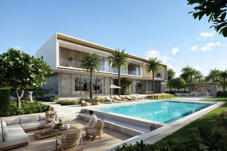
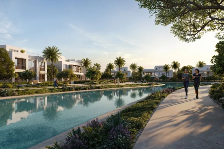
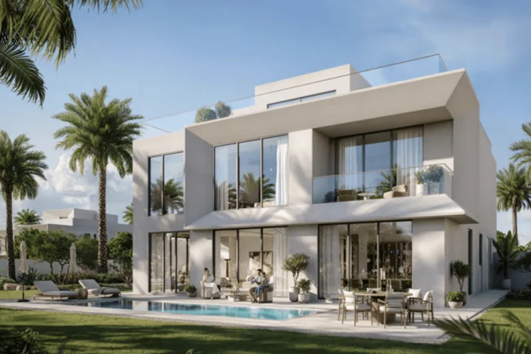
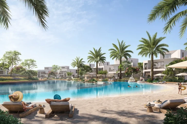
Mirage The Oasis is a named residential enclave within The Oasis by Emaar in DubaiLand. The area is presented in developer materials as part of a masterplanned neighbourhood; original concept images and the initial masterplan have been published and can be compared with later stages as the scheme progresses. Official transaction records list active sales in the area, and a concise picture of local access, community context and planning material follows.
Mirage The Oasis is positioned inside The Oasis development in DubaiLand. The site appears in developer documentation and marketing as one element of the wider masterplan for The Oasis by Emaar. Available materials include the original masterplan and concept designs that were released at launch; these documents are often used to compare intention versus delivered detail during subsequent construction and handover phases.
The entry for the location is recorded on public property portals and in official transaction compilations. At the time of the most recent compilation there are fifty sale transaction records associated with Mirage The Oasis held in the Dubai Land Department data set made available through open data initiatives.

Public transport and road travel times cited for Mirage The Oasis reflect typical driving conditions and recorded proximities to major Dubai destinations.
These travel times are summary figures provided alongside the site data and are useful as general orientation for commuting and access to city amenities.
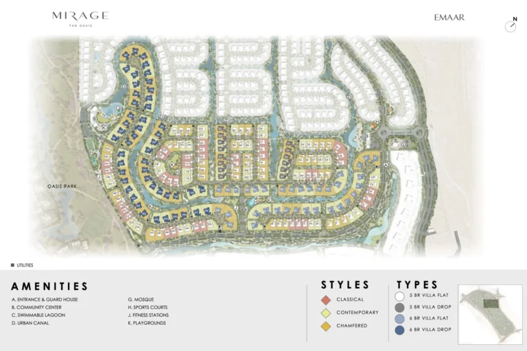
Mirage The Oasis is associated with The Oasis by Emaar masterplan. The documented materials include original masterplan images and early concept design illustrations. Such materials serve as a reference point for the design intent; the published commentary accompanying the images emphasises that projects frequently undergo design revisions as they progress, and delivered features may differ from initial concepts. The available official property records compile transactional activity for the location but do not constitute an exhaustive construction status report.
Within the factual dataset supplied for this guide there are no individual projects listed as “on site” with linked pages, and no separate nearby projects enumerated in the provided compilation. For users interested in developer-supplied concept imagery and masterplan comparison, the original launch visuals are cited in the developer documentation and in public property portals that carry the location entry.
Available public material notes proximity to established schools: South View School is referenced at approximately 3.2 km from the locality and Royal Grammar School Guildford in Dubai is referenced at approximately 3.7 km. These distances are published in the same locality summary that lists transport and travel times.
The local lifestyle summary compiled with the location data also highlights partnerships with local leisure and dining guides, specifically LadiesNightDubai.com and BrunchCrunch.ae, which provide listings of current offers and events in the wider vicinity. Those resources are presented as external guides to hospitality and leisure options near the area rather than features of the development itself.
Based on its placement within a masterplanned district and the travel-time orientation to central and leisure destinations, Mirage The Oasis may be of interest to buyers and renters looking for residential units within a planned DubaiLand community context. The proximity indicators to several schools suggest the location is presented with family-oriented access in mind. The record of fifty sale transactions indicates active market movement in the area as reflected in official land department data.
Suitability considerations to evaluate in more detail for any buyer or tenant include personal commuting patterns, reliance on private cars versus public transport, and the implications of masterplan evolution for expected amenities and landscaping. The originally published concept imagery can be consulted to understand initial intent, while observing that delivered outcomes may vary.
The official compiled data linked to the location lists fifty sale transaction records.
The nearest recorded metro reference is the Red Line with station code R73 at an approximate mapped distance of 5,310 metres; the location is noted as not walkable to that station.
Reported approximate car travel times are: Dubai Mall — 44 minutes; Palm Jumeirah — 38 minutes; Burj Al Arab — 40 minutes; The Walk JBR — 43 minutes. Airport drives are reported as 48 minutes to DXB and 34 minutes to Al Maktoum International Airport.
Yes. The original masterplan and concept design images were published at launch and are referenced in locality summaries. Those materials are available for comparison with the scheme as it progresses, and commentary accompanying the visuals highlights potential design revisions between concept and delivery.
For further technical details, transaction listings and the locality entry as published on a public property portal, consult the official location record hosted on property listing platforms and the Dubai Land Department open data compilations. The location is recorded within the hierarchy: Dubai > DubaiLand > The Oasis by Emaar > Mirage The Oasis.
Machine-readable mirrors of this page: Markdown · JSON. Every field carries its origin.
How to cite:Mirage The Oasis — Continental Club Property, 2026-07-30, https://continentalclub.ae/location/mirage-the-oasis/
Dubai market as a whole: prices, transactions and trends (DLD data) →





Neighbouring areas and sub-communities to compare location and prices.