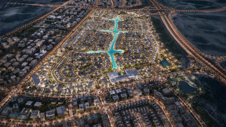
South Bay 3 is a residential subcommunity within the South Bay sector of the Dubai South (Dubai World Central) masterplan. It occupies coordinates 24.948626, 55.213173 and forms part of the broader Dubai South residential district. The location is intended to sit close to the emirate’s southern logistics and aviation hub and to the Expo City area, with masterplan visuals available for reference during the development process.
South Bay 3 belongs to the South Bay cluster, a named sub-area inside Dubai South. Administratively it is recorded under the Dubai South residential district and marketed as a residential sector within the larger Dubai World Central precinct. The community sits toward the southern edge of Dubai, oriented toward Al Maktoum International Airport (DWC) and the Expo City developments.
Coordinates: latitude 24.948626, longitude 55.213173. The official path used in listings identifies the area as: Dubai, Dubai South (Dubai World Central), Residential District, South Bay, South Bay 3.

Metro: the closest metro reference is the Red Line station coded R76, at a distance of approximately 6,948 metres from the subcommunity. That distance is not considered walkable as a daily pedestrian commute.
Key road distances from South Bay 3 (approximate, by road):
Typical driving times reported for the area (indicative): roughly 39 minutes to Dubai Mall, 35 minutes to Palm Jumeirah, 37 minutes to Burj Al Arab and 37 minutes to The Walk JBR. Dubai International Airport (DXB) is reported at approximately 39 minutes by car and Al Maktoum International Airport at roughly 20 minutes by car. These journey times are general estimates and depend on route choice and traffic conditions.

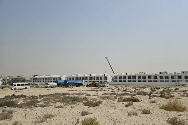
South Bay 3 appears as part of a larger masterplan for South Bay within Dubai South. Concept images showing initial designs have been publicly referenced; such images are intended to help compare the original plans with eventual delivery, and developers commonly revise designs, amenities and landscaping during the development lifecycle. The available public material emphasises that concept artwork may not reflect the final built environment.
Public records and transactional data: there are 50 sale transaction records associated with South Bay 3 that are drawn from Dubai Land Department data and published under the government’s Open Data initiative. This transactional information is maintained in public registries and updated on business days according to the data provider’s schedule.

Within the immediate neighbourhood, one school is specifically referenced in available summaries: The International School of Choueifat (DIP), cited at 5.9 km from South Bay 3. Broader amenity listings for the area are typically aggregated in portal summaries and in local maps that accompany development presentations; food-and-leisure guides for the vicinity are also compiled via local partnerships for event and dining listings.
South Bay 3 is positioned for buyers or occupiers prioritising proximity to Dubai South’s strategic infrastructure: the Al Maktoum airport complex, logistics facilities, and the Expo City node. Its location appeals to people who value relatively short access to Expo City and to the southern airport, and who prefer residential choices detached from central Dubai’s built-up core.
Practical use cases include:
Q: How far is the nearest metro station?
A: The referenced Red Line station (code R76) is about 6,948 metres from South Bay 3; this distance is generally not considered walkable for daily commuting.
Q: What are the main travel times to central Dubai and to airports?
A: Indicative driving times reported for the area include roughly 39 minutes to Dubai Mall and to Dubai International Airport, about 35 minutes to Palm Jumeirah, and around 20 minutes to Al Maktoum International Airport, depending on traffic and route.
Q: Are there transaction records or public data for the subcommunity?
A: Yes. Publicly available data lists 50 sale transaction records for South Bay 3 sourced from the Dubai Land Department under the Open Data directive; these records are published and updated on business days.
Q: What is the current stage of the planned development?
A: Public material for South Bay 3 includes initial concept images and masterplan references. Concept artwork and early designs are a guide only; developers commonly adjust designs, amenities and landscaping during project progression, so final delivery may differ from those initial illustrations.
Further technical details, legal records and up-to-date transactional searches can be obtained through official Dubai Land Department channels and through the public property portals that aggregate Dubai South listings. Visitors or potential buyers should consult the registered development documents and current marketing literature for the most recent status updates on delivery and infrastructure.
Machine-readable mirrors of this page: Markdown · JSON. Every field carries its origin.
How to cite:South Bay 3 — Continental Club Property, 2026-07-30, https://continentalclub.ae/location/south-bay-3/
Dubai market as a whole: prices, transactions and trends (DLD data) →
Largest management companies in the area: Kaizen Owner Association Management Services (24), Dubai South Community Management Dwc- (2), Emaar Community Management (2).
Check any building’s service charge → All communities
RERA-approved 2026 budgets from the DLD service charge index (Mollak); residential buildings. Rate is AED per sq ft per year; YoY compares the same buildings in 2025.
Neighbouring areas and sub-communities to compare location and prices.