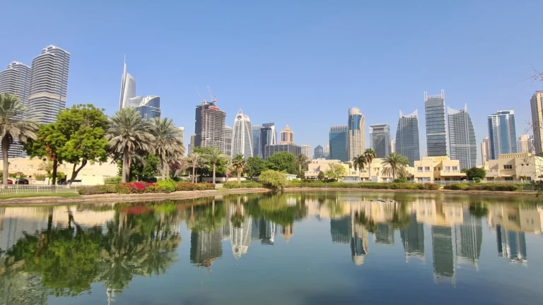
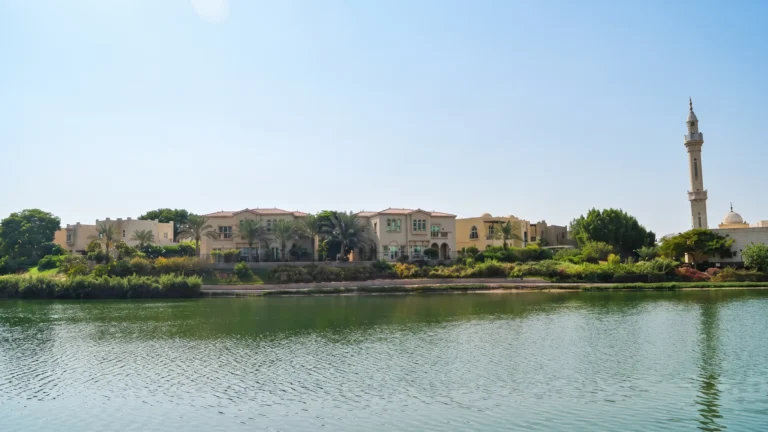
Islamic Clusters is a district of Dubai, 2.4 km from DMCC Metro Station.
Islamic Clusters is a defined subcommunity within the Jumeirah Islands area of Dubai. It forms part of the wider Jumeirah Islands neighbourhood network along Dubai’s western coastal corridor.
Islamic Clusters is a subcommunity of Jumeirah Islands, located at 25.059691°N, 55.158663°E. It sits within the Jumeirah Islands masterplan.

The nearest Dubai Metro access is on the Red Line, at station R37, approximately 2,361 metres from the area. This is generally beyond a comfortable walking distance.
Road distances to key Dubai destinations include:
Indicative driving times include roughly 22 minutes to Dubai Mall, about 14 minutes to Palm Jumeirah, around 19 minutes to Burj Al Arab and about 14 minutes to The Walk JBR. Airport journeys take approximately 30 minutes to Dubai International Airport (DXB) and 33 minutes to Al Maktoum International Airport, depending on traffic and route choice.
Islamic Clusters is part of the wider Jumeirah Islands community. The surrounding area offers access to parks, beaches, golf facilities and cinemas, providing a range of leisure options nearby.
Nearby educational facilities include Emirates International School Meadows, approximately 0.8 km away, and Dubai British School Emirates Hills, around 1.5 km away. These schools can be convenient for families considering daily school commutes.
Dubai Marina, JBR and Palm Jumeirah are all within a short drive, offering retail, dining and beachfront leisure options. Larger shopping and business destinations, including The Dubai Mall, Business Bay and DIFC, are within a broader commuting distance.
Islamic Clusters suits residents seeking a residential enclave within Jumeirah Islands, with relatively direct road access to Dubai Marina and Palm Jumeirah. Its location appeals to households prioritising coastal and leisure destinations while remaining connected to central and southern Dubai by car.
The nearby schools make the area relevant for families assessing school commute times. Professionals working in Dubai Marina, JBR or nearby business districts may also find the location convenient by car, while the Red Line metro station is best reached by a short drive or taxi ride.
Q: Where is Islamic Clusters located?
A: It is a subcommunity of Jumeirah Islands in Dubai, located at 25.059691°N, 55.158663°E.
Q: How close is the nearest metro station?
A: The nearest Dubai Metro Red Line station, R37, is approximately 2,361 metres from the community and is generally reached by car or a short taxi trip.
Q: What are the distances to major landmarks?
A: Road distances include about 19.6 km to The Dubai Mall, 3.0 km to Dubai Marina, 6.2 km to Palm Jumeirah and 29.9 km to Dubai International Airport (DXB). Driving times are roughly 22 minutes to Dubai Mall and 14 minutes to Palm Jumeirah, subject to traffic.
Q: Are there schools nearby?
A: Emirates International School Meadows is approximately 0.8 km away, while Dubai British School Emirates Hills is around 1.5 km from the community.
Machine-readable mirrors of this page: Markdown · JSON. Every field carries its origin.
How to cite:Islamic Clusters — Continental Club Property, 2026-09-02, https://continentalclub.ae/location/islamic-clusters/
Dubai market as a whole: prices, transactions and trends (DLD data) →
Largest management companies in the area: Highrise Owners Association Management Services (6), Provis Owners Association Management Services (6), Dh Community Management (5).
Check any building’s service charge → All communities
RERA-approved 2026 budgets from the DLD service charge index (Mollak); residential buildings. Rate is AED per sq ft per year; YoY compares the same buildings in 2025.




Neighbouring areas and sub-communities to compare location and prices.