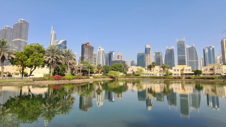
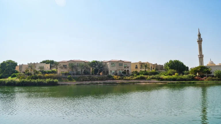
Cluster 16 to 20 is a district of Dubai, 2.6 km from DMCC Metro Station.
Cluster 16 to 20 is a named part of the Jumeirah Islands area in Dubai. The name is used in property directories and community indexes to identify a specific grouping inside Jumeirah Islands. Descriptions and listing portals treat the cluster designation as a reference point for access to central Dubai, key leisure destinations and a number of nearby schools. This page summarises transport links, typical access times to major destinations, references to nearby education provision and practical considerations for those looking at the area for living or investment.
Cluster 16 to 20 sits within the broader Jumeirah Islands location in Dubai. In market listings it is presented as a cluster-based sub-location inside that community. The cluster label is used to group neighbourhoods within Jumeirah Islands for navigation and property search purposes. Official and third‑party property portals include Cluster 16 to 20 in their site maps and community guides, alongside summaries of nearby attractions, parks, beaches, golf facilities and cinemas.

Transport-wise the cluster is positioned for road access across central and coastal Dubai. Measured travel times from Cluster 16 to 20 to several key Dubai destinations are commonly cited as follows:
Air connections by road are similarly straightforward: Dubai International Airport (DXB) is usually reached in about 31 minutes and Al Maktoum International Airport in about 32 minutes, according to commonly referenced driving-time estimates. These travel times are indicative and reflect typical conditions used in community summaries.
Public transport access includes a reference to the Dubai Metro Red Line. The nearest metro point is identified with station code R37 on the Red Line and is located at a distance of 2,629 metres from the cluster. That distance places the metro beyond what many would consider a comfortable walking distance; therefore, journeys that use the metro will typically require a short drive, taxi or local feeder transport to reach the station entrance.
The Cluster 16 to 20 designation is used in property listings and community guides rather than as the name of a single development project. As such, information about specific projects or buildings tied directly to the cluster label is presented in indexes and property portals as part of the wider Jumeirah Islands coverage. Community and building guides produced by local property platforms often accompany listings to help buyers, renters and investors familiarise themselves with the local context, access and amenities.
For anyone researching properties by cluster, standard practice on listing portals is to combine the cluster reference with individual development or villa listings, plus nearby community amenities. When using such indexes, consult the listing details or contact the advertising agent to confirm the exact street, plot or development name associated with any specific property of interest.
Cluster 16 to 20 is suitable for people who prioritise road connectivity to beaches, coastal leisure and central Dubai destinations while retaining the convenience of nearby education provision. The area is commonly referenced in relation to local schools: Emirates International School Meadows and Dubai British School Emirates Hills are each cited at around 1.0 km from the cluster, offering proximate schooling options that are relevant when considering family residence or rental demand.
Commuters who travel by car to Dubai Mall, Palm Jumeirah, Burj Al Arab or JBR will find the stated driving times convenient for daily or weekly access. Users of public transport should factor in the need for a short feeder trip to reach the Red Line metro station identified by code R37.
How long does it take to drive from Cluster 16 to 20 to central Dubai landmarks?
Typical driving-time references list about 22 minutes to Dubai Mall, 14 minutes to Palm Jumeirah, 20 minutes to Burj Al Arab and 15 minutes to The Walk JBR.
Which metro line serves the area and how far is the nearest station?
The Dubai Metro Red Line is the relevant line. The nearest referenced station has code R37 and is approximately 2,629 metres from Cluster 16 to 20, a distance that generally requires a short vehicle trip to reach.
What airports are within driving distance?
Reported driving estimates place Dubai International Airport (DXB) at roughly 31 minutes and Al Maktoum International Airport at roughly 32 minutes from the cluster by road.
Are there schools near Cluster 16 to 20?
Community summaries note Emirates International School Meadows and Dubai British School Emirates Hills at around 1.0 km distance from the cluster, indicating close access to established schooling options.
Machine-readable mirrors of this page: Markdown · JSON. Every field carries its origin.
How to cite:Cluster 16 to 20 — Continental Club Property, 2026-09-02, https://continentalclub.ae/location/cluster-16-to-20/
Dubai market as a whole: prices, transactions and trends (DLD data) →
Largest management companies in the area: Highrise Owners Association Management Services (6), Provis Owners Association Management Services (6), Dh Community Management (5).
Check any building’s service charge → All communities
RERA-approved 2026 budgets from the DLD service charge index (Mollak); residential buildings. Rate is AED per sq ft per year; YoY compares the same buildings in 2025.




Neighbouring areas and sub-communities to compare location and prices.