Al Twar 2 is a district of Dubai, 815 m from Al Qusais Metro Station.
Al Twar 2 is a defined subcommunity within the wider Al Twar area in Deira, Dubai. It sits close to Dubai International Airport and forms part of the eastern urban districts of the city. This page summarizes the location, transport connections, recorded transactions, nearby facilities that are explicitly documented, and practical pointers for people considering living in or assessing property in the area.
Al Twar 2 is catalogued as a subcommunity of Al Twar in the Deira sector of Dubai. Its geographic coordinates are approximately 25.262004 N, 55.379346 E. Administratively and on mapping services it appears as a neighbourhood within Dubai that lies to the north-east of the main Downtown and Business Bay precincts and immediately west of the airport precincts that serve Dubai International Airport (DXB).
Official sources report a set of recorded sale transactions for Al Twar 2: the Dubai Land Department records show 50 sale transaction records associated with this subcommunity (as published under the government – s Open Data directive). These records provide a basis for understanding recent market activity within the area; they are published routinely by the Land Department on working days.
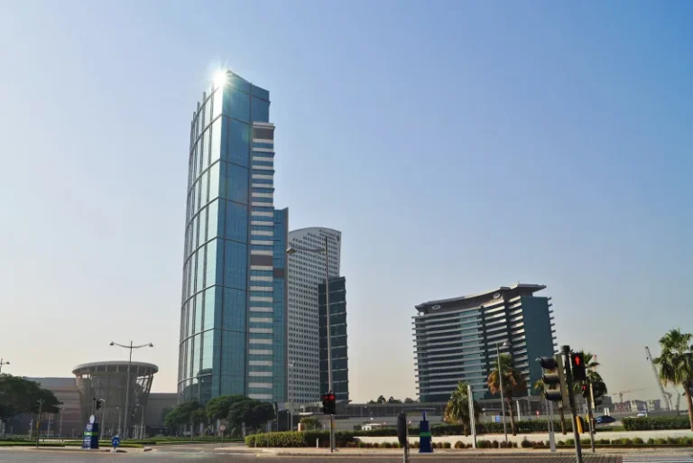
Al Twar 2 benefits from proximity to both public transport and major road corridors. The nearest metro access on the Dubai Metro Green Line is identified as station code G12; the recorded walking distance to the station is about 815 metres, and the location is described as walkable to that metro stop.
Distances by road to several of Dubai – s principal destinations (as recorded) are:
Because DXB is recorded as only about 1.7 km away, the subcommunity is particularly convenient for people with frequent air travel needs or for those whose work or services are airport-proximate. Road distances to central business and leisure districts are typical for an inner-city Deira location and provide relatively direct routes to Downtown and the coastal clusters by the main arterial roads.
Al Twar 2 is identified as a subcommunity rather than a named master development. There are zero specific projects on-site and no projects nearby at this location. There are no project entries included with URLs or developer attributions in the supplied facts, and no registry numbers for building counts were provided in the data set. As a result, project-specific links or developer listings are not included here.
What is documented in the available material is the presence of residential and community uses in the Al Twar area generally, and nearby amenities and institutions that serve local residents. Two schools are explicitly mentioned in authoritative local summaries as being in close proximity to Al Twar 2: Al Salam Community School (reported at roughly 0.2 km) and Star International School Al Twar (reported at roughly 0.3 km). These distances indicate immediate neighbourhood access to schooling facilities.
Based on the recorded facts about location and transport, Al Twar 2 is a subcommunity that can be considered by a range of occupants and property users:
These suitability notes rely only on documented geographic and institutional facts and on recorded transport proximity; individual preferences for building type, unit size, or facilities will depend on specific listings and properties within Al Twar 2.
Q: Where is the nearest metro station and how far is it on foot?
A: The nearest metro access is on the Dubai Metro Green Line (station code G12). The recorded distance to that station is about 815 metres and the location is described as walkable to the metro.
Q: How close is Al Twar 2 to Dubai International Airport?
A: The documented road distance to Dubai International Airport (DXB) is approximately 1.7 km.
Q: Are there schools near Al Twar 2?
A: Local summaries list Al Salam Community School at about 0.2 km and Star International School Al Twar at about 0.3 km from the subcommunity.
Q: How many recent sale transactions are recorded for Al Twar 2?
A: The Dubai Land Department records, as published under the Open Data directive, show 50 sale transaction records associated with Al Twar 2 in the available dataset.
Machine-readable mirrors of this page: Markdown · JSON. Every field carries its origin.
How to cite:Al Twar 2 — Continental Club Property, 2026-08-30, https://continentalclub.ae/location/al-twar-2/
The figures below come from registered Dubai Land Department transactions, not from listings. We show the median rather than the mean, so that one-off penthouses do not distort it.
Source: Dubai Land Department transaction registry. Prices per square metre, sale transactions.
Dubai market as a whole: prices, transactions and trends (DLD data) →




Neighbouring areas and sub-communities to compare location and prices.
