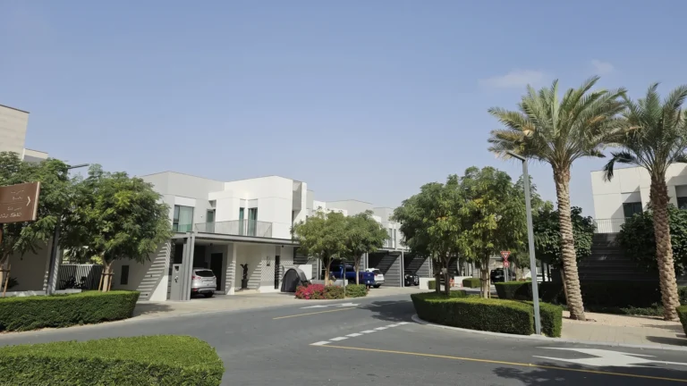
Rise by Athlon is a district of Dubai.
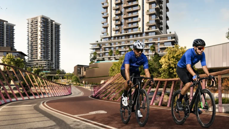
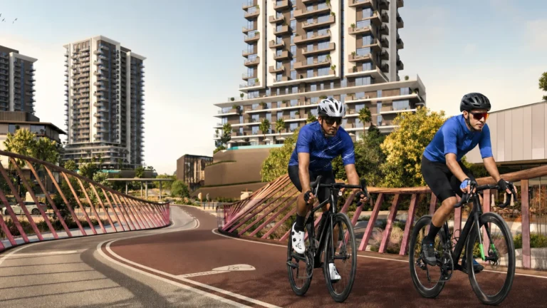
Rise by Athlon is a planned residential enclave within the Athlon masterplan in Wadi Al Safa 5, DubaiLand. The development is centred on structured open space and an integrated movement network designed around active-wellness principles. The layout prioritises walking and cycling connections, a central Athlon Park and a series of programmed outdoor loops for running, cycling and family recreation.
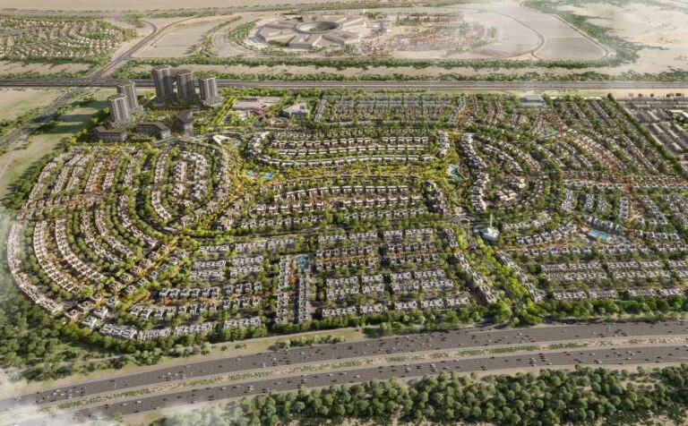
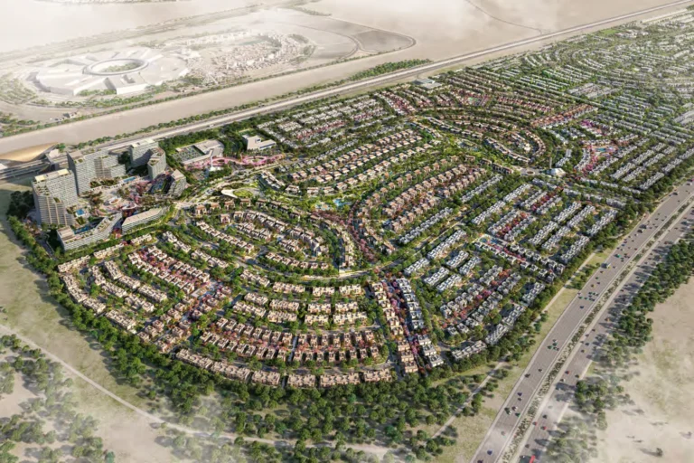
Rise by Athlon is part of the broader Athlon community in Wadi Al Safa 5, DubaiLand. The site-level design arranges buildings and public space around a central green, Athlon Park, and a connected system of pathways. The community contains five high-rise residential buildings and three low-rise residential buildings. Concept imagery and masterplan material provided for the project show the original design intent and public realm strategy; these materials are illustrative, and project designs can be revised during delivery.

The nearest Dubai Metro reference in project data is on the Red Line (station code R31). The recorded distance to that metro reference point is approximately 12,481 metres; this distance has been noted as not walkable in the project description. Transport access within Athlon is organised around internal pedestrian and cycling routes rather than direct, short walking connections to metro stations.
Internally, the masterplan emphasises short walking times to facilities: the site circulation is designed so residents are within a two-minute walk of an activity node on the wellness network. Public and private transport options beyond the masterplan footprint are accessed via Dubai’s arterial road network from Wadi Al Safa 5 / DubaiLand.

The Rise by Athlon grouping comprises multiple residential blocks of differing scale. The community-level organisation includes both high-rise towers and lower-rise terraces around the central park and podiums.
These project pages link to individual building information where available. The masterplan groups residences around shared podiums and landscape corridors that connect into the broader Athlon active-wellness network.

The defining feature of Rise by Athlon is its active-wellness approach embedded into the site layout. The pedestrian and cycling network links parks and green spaces and provides dedicated routes for different user types. The planned activity loops are specified as a 4.6 km trail-running loop, a 3.7 km cycling loop and a 2.2 km family-friendly loop.
Specialist indoor and community facilities indicated by the project description include two gyms (one located within a terraced podium), a recovery studio, a social fitness hub, a rhythm room and a mind and body library. Public open space is focused around Athlon Park and the connecting green corridors to support outdoor activity and circulation.

Rise by Athlon is organised to appeal to residents who prioritise active lifestyles and ready access to outdoor exercise routes. The integrated walking and cycling paths, multiple looped routes for running and cycling, and dedicated onsite fitness facilities make the location appropriate for people who use daily exercise as part of their routine. The mix of high-rise and low-rise buildings may suit a range of household types, from individuals and couples to families who value nearby green space and programmed outdoor routes.

The project notes several established schools in the wider area. Two specifically referenced schools are Jumeirah English Speaking School Arabian Ranches (approximately 3.4 km) and GEMS Winchester School, Dubai (approximately 3.6 km). The masterplan and supporting materials reference local retail and leisure clusters in the broader DubaiLand area rather than specific on-site retail operators.
Official transaction information has been recorded for Rise by Athlon; there are 50 sale transaction records available through the Dubai Land Department and Open Data publications as cited in project sources. Concept images and masterplan graphics are published alongside project summaries to illustrate the original design intent; these are provided for comparison with any realised development.
Yes. A central open space named Athlon Park is the focal point of the masterplan, with buildings and circulation arranged to connect to this park.
The scheme integrates dedicated walking and cycling pathways and three programmed loops (4.6 km running, 3.7 km cycling, 2.2 km family loop), plus indoor facilities such as two gyms, a recovery studio, a social fitness hub, a rhythm room and a mind and body library.
The referenced metro line is the Red Line (station code R31) at a recorded distance of about 12,481 metres; the project description notes that this metro point is not walkable from Rise by Athlon.
Transaction records for the development are published through Dubai Land Department open data channels; the project summary also publishes initial concept images and masterplan artwork as supplied by the developer and project team.
Machine-readable mirrors of this page: Markdown · JSON. Every field carries its origin.
How to cite:Rise by Athlon — Continental Club Property, 2026-07-30, https://continentalclub.ae/location/rise-by-athlon/
The figures below come from registered Dubai Land Department transactions, not from listings. We show the median rather than the mean, so that one-off penthouses do not distort it.
| Building | Deals | Price per m² |
|---|---|---|
| AZUL | 160 | 17 851 |
| CYAN | 154 | 17 744 |
| NEON | 154 | 17 770 |
| TEAL | 131 | 17 700 |
| MAGENTA | 65 | 17 743 |
| GRID | 61 | 17 033 |
| FOUNDRY | 57 | 17 361 |
| TEMPO | 52 | 15 653 |
Source: Dubai Land Department transaction registry. Prices per square metre, sale transactions.
Dubai market as a whole: prices, transactions and trends (DLD data) →
Largest management companies in the area: Provis Owners Association Management Services (6), Kaizen Owner Association Management Services (4), Stratum Owner Association Management Services (3).
Check any building’s service charge → All communities
RERA-approved 2026 budgets from the DLD service charge index (Mollak); residential buildings. Rate is AED per sq ft per year; YoY compares the same buildings in 2025.
Neighbouring areas and sub-communities to compare location and prices.