Juniper Way is a tower-level address within Jumeirah Golf Estates, positioned in southern Dubai. The location is defined by residential and leisure uses that orbit the golf course neighbourhood; coordinates 25.023468, 55.205221 place it squarely in the Jumeirah Golf Estates community. The entry below summarises where Juniper Way sits in the city, how it connects to major points, what to expect from the immediate built environment and who will find the location most suitable.
Juniper Way is identified as a tower within the Jumeirah Golf Estates master area. The site path used in official descriptions runs: Dubai > DubaiLand > Me’aisem First > Jumeirah Golf Estates > Juniper Way. Administratively and geographically the tower is part of the broader Jumeirah Golf Estates community, a district known for its landscaped settings and golf facilities. The coordinates for Juniper Way are 25.023468 latitude and 55.205221 longitude.
Public transport access at walking distance is limited. The nearest Dubai Metro station on the Red Line is coded R73 and is approximately 4.274 kilometres from Juniper Way, which is not typically considered walkable for daily commuting. Road access is the practical travel mode for most journeys.
Distances to key Dubai destinations, measured in kilometres from Juniper Way, are approximately:
Practical driving times quoted in local summaries give an approximate sense of journey length by car: it takes roughly 28 minutes to drive to The Dubai Mall, about 23 minutes to Palm Jumeirah, and around 25 minutes to both Burj Al Arab and The Walk JBR under typical traffic conditions. Airport transfer approximations conveyed in local sources indicate roughly 34 minutes to Dubai International Airport (DXB) and about 36 minutes to the newer Al Maktoum International Airport by road; individual travel times vary with traffic and route choice.
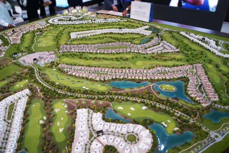
Juniper Way is recorded as a tower within the Jumeirah Golf Estates complex. The immediate area is primarily shaped by the golf estate masterplan: clustered residential plots, landscaped open spaces and supporting leisure infrastructure are characteristic of the wider community. The factual record provided does not list projects directly on site or in immediate adjacency under distinct project names for citation, nor does it list child sub-districts under Juniper Way.
Local guides and databases that map the area typically present summaries of nearby attractions, parks, beaches, golf clubs and cinemas for convenience. Those compilations are used as orientation tools by buyers and renters considering properties in the estate.
Community resources are referenced in local descriptions. Two schools specifically cited within proximity to Juniper Way are GEMS School of Research and Innovation at about 2.9 km and Victory Heights Primary School at about 3.0 km. Beyond these examples, the neighbourhood relies on a mixture of district schools, leisure facilities and retail consolidated across Jumeirah Golf Estates and surrounding zones. A mix of hospitality and dining options across adjacent districts supports weekend and social activities.
Juniper Way is suited to residents who prioritise a setting integrated with golf-course landscaping and relatively low-density residential character compared with Dubai’s high-rise cores. It is a fit for households or individuals seeking quieter neighbourhoods while retaining car access to Dubai’s principal activity centres. Professionals commuting to central business districts should plan daily journeys by road; proximity to Dubai Marina, JBR and Palm Jumeirah keeps lifestyle and leisure destinations within reasonable driving reach.
Investors or occupiers who place importance on nearby schooling options will note the specific local schools referenced within short driving distances. The community context also appeals to those who value outdoor amenities associated with golf estates and managed landscaping.
Where exactly is Juniper Way?
Juniper Way is a tower location within Jumeirah Golf Estates in southern Dubai; coordinates are 25.023468, 55.205221 and the site appears in local routing as part of the Jumeirah Golf Estates area.
How close is the metro?
The nearest Dubai Metro Red Line station is listed as code R73 and sits about 4.274 km away, which is not typically considered a walking commute.
How long does it take to reach major Dubai landmarks?
Typical quoted driving times are around 28 minutes to The Dubai Mall, about 23 minutes to Palm Jumeirah and roughly 25 minutes to Burj Al Arab and The Walk JBR; distances in kilometres to principal points are provided in local summaries and include, for example, Dubai Marina at about 9.1 km and Downtown Dubai at about 20.5 km.
Are there schools nearby?
Local information references GEMS School of Research and Innovation (approximately 2.9 km) and Victory Heights Primary School (approximately 3.0 km) among nearby schooling options.
Machine-readable mirrors of this page: Markdown · JSON. Every field carries its origin.
How to cite:Juniper Way — Continental Club Property, 2026-09-02, https://continentalclub.ae/location/juniper-way/
Dubai market as a whole: prices, transactions and trends (DLD data) →
Largest management companies in the area: Deyaar Community Management (17), Wasl Owners Association Management Services (8), Stratum Owner Association Management Services (4).
Check any building’s service charge → All communities
RERA-approved 2026 budgets from the DLD service charge index (Mollak); residential buildings. Rate is AED per sq ft per year; YoY compares the same buildings in 2025.

Neighbouring areas and sub-communities to compare location and prices.
