Whitefield is a subcommunity within the Damac Hills masterplan in Dubailand. It occupies a defined pocket of the wider Damac Hills complex and is represented in the original masterplan published by the developer at the time of launch. The area appears in public records: there are 50 sale transaction records for Whitefield recorded by the Dubai Land Department and published under the government’s Open Data initiative.
Whitefield is administratively a subcommunity of Damac Hills and forms part of the broader DubaiLand area. In broad terms it belongs to the Dubailand sector of Dubai and is positioned to the north-west of Dubai’s central business districts. Coordinates recorded for Whitefield are approximately 25.028321°N, 55.250121°E. The community is mapped within the original Damac Hills masterplan and is commonly referenced alongside neighbouring leisure, residential and retail elements that make up the larger development.

Public transport access: the nearest Dubai Metro line is the Red Line. The closest metro reference in official records is station code R73, at an approximate straight-line distance of 8,829 metres from the Whitefield coordinates; this distance is not considered walkable for daily commuting on foot.
Road distances from Whitefield to key Dubai destinations (approximate, as recorded in the location facts):
Typical driving times quoted in official summaries give practical context: roughly 24 minutes to Dubai Mall, about 22 minutes to Palm Jumeirah, around 21 minutes to Burj Al Arab, and 25 minutes to The Walk JBR. Airport driving times cited in the same source are roughly 29 minutes to Dubai International Airport (DXB) and roughly 26 minutes to Al Maktoum International Airport (DWC). Actual travel times depend on traffic and route chosen.

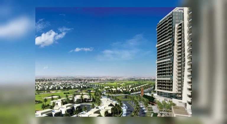
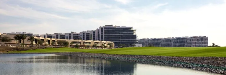
Whitefield is recorded as part of the Damac Hills master development. The original masterplan documents for Damac Hills set out a mix of residential parcels, green spaces and leisure elements; Whitefield sits within that overall structure. Public-facing summaries of the area include mapped locations of nearby attractions, parks, beaches, golf facilities and cinemas (these summaries are typically provided alongside the community map).
Transaction activity is publicly available through the Dubai Land Department open data feed; the available extract for Whitefield notes 50 sale transaction records. Local property listings and community guides that reference Whitefield are aggregated on specialist portals and can be consulted for specific units, floor plans and current availability.

Recorded proximity to schools in official locality notes lists GEMS Metropole School Motor City at approximately 1.9 km from Whitefield and Jebel Ali School at approximately 2.0 km. Community guides and local listings also cite nearby leisure and dining offers; third-party local services compile rotating information about weekly offers (for example, ladies’ nights and brunches) in the wider vicinity.

Whitefield’s position within Damac Hills and its road links make it relevant for those prioritising a residential address inside the Dubailand cluster with direct driving access to central Dubai and coastal districts. The recorded proximity to established schools is a factor for families evaluating school commutes. The availability of transaction records and listing activity also means the area is regularly referenced by buyers and agents monitoring the Damac Hills submarkets.

Q: Where exactly is Whitefield?
A: Whitefield is a subcommunity of Damac Hills in Dubailand. Its coordinates are approximately 25.028321°N, 55.250121°E and it sits within the Damac Hills masterplan area.
Q: How can I commute to central Dubai from Whitefield?
A: The nearest Dubai Metro Red Line reference is station code R73 at about 8.8 km from Whitefield (not considered walkable). By car, typical travel times to major destinations are given in public summaries: roughly 24 minutes to Dubai Mall, about 22 minutes to Palm Jumeirah and approximately 21 minutes to Burj Al Arab, subject to traffic.
Q: Are there recent sales records for Whitefield?
A: Official open-data extracts note 50 sale transaction records for Whitefield recorded by the Dubai Land Department.
Q: What schooling is close to Whitefield?
A: Published locality notes list GEMS Metropole School Motor City at roughly 1.9 km and Jebel Ali School at roughly 2.0 km from Whitefield.
Machine-readable mirrors of this page: Markdown · JSON. Every field carries its origin.
How to cite:Whitefield — Continental Club Property, 2026-07-30, https://continentalclub.ae/location/whitefield/
Dubai market as a whole: prices, transactions and trends (DLD data) →
Largest management companies in the area: Luxury Owner Association Management Services Co. (45).
Check any building’s service charge → All communities
RERA-approved 2026 budgets from the DLD service charge index (Mollak); residential buildings. Rate is AED per sq ft per year; YoY compares the same buildings in 2025.







Neighbouring areas and sub-communities to compare location and prices.
