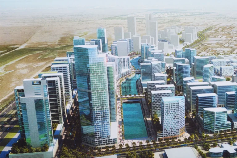
Sobha Hartland Greens is a district of Dubai.
Sobha Hartland Greens is a residential enclave inside the larger Sobha Hartland masterplan located within Mohammed Bin Rashid City, under the Meydan / Meydan One area hierarchy. The name denotes a collection of buildings and landscaped spaces intended to be part of the Sobha Hartland offering; published materials include concept images and development illustrations that help compare original plans with the realised development. The area is regularly referenced in Dubai Land Department records and property portals, with a number of sales transactions recorded for properties marketed as Sobha Hartland Greens.
Sobha Hartland Greens forms a sub‑component of Sobha Hartland, itself positioned within the Mohammed Bin Rashid City development corridor and accessible from the Meydan / Meydan One axis. The community name is used to identify the particular grouping of buildings and open spaces that are part of the Sobha Hartland master development. Location identifiers used by property databases place the community in that nested sequence: Dubai > Mohammed Bin Rashid City > Meydan > Meydan One > Sobha Hartland > Sobha Hartland Greens.
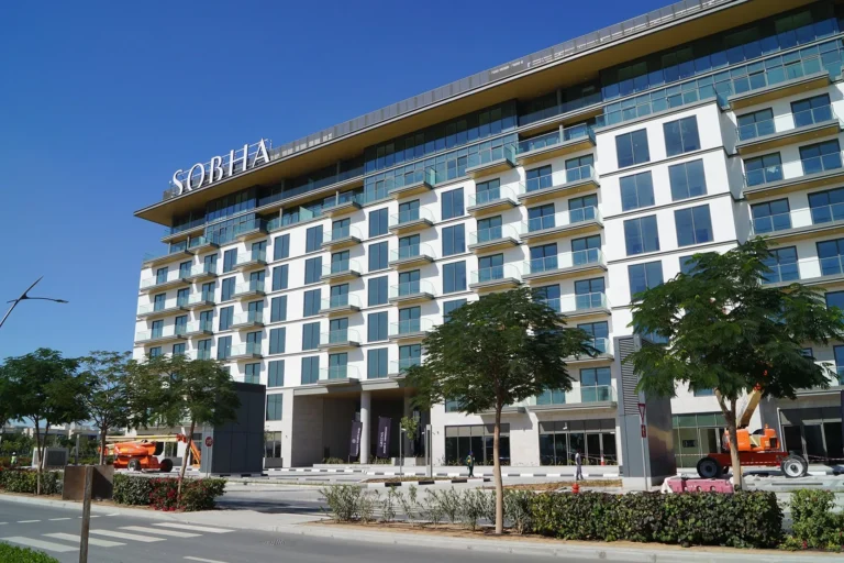
Published visuals for Sobha Hartland Greens include concept designs and scheme images. These are useful for comparing early proposals with on‑site results; developers sometimes revise designs, landscaping and amenity lists during delivery, so concept artwork should be seen as illustrative rather than definitive.
Public transport and road access are commonly cited when assessing Sobha Hartland Greens. The nearest metro reference in common datasets is the Red Line, station code R25, at an approximate distance of 4,854 metres; this distance is treated as not walkable in the same sources, indicating the requirement for a short drive, shuttle or feeder transport to reach the metro network.
Representative driving times quoted in property listings and locality summaries give a sense of connectivity to major Dubai destinations (typical travel times under normal traffic conditions):
Those travel times are presented as practical references used in property materials and reflect typical routing from the Sobha Hartland area rather than guaranteed commute times.

Sobha Hartland Greens is referenced in developer and property directories as a specific part of the Sobha Hartland offering. Project level information that is publicly linked to the community includes at least one named scheme; for direct reference see the project link below:
Local property databases record transactions associated with Sobha Hartland Greens; at the time of publication there are 50 sale transaction records attributed to the community in the Dubai Land Department open dataset used by property portals. Published maps and project pages commonly show building locations, internal roads and amenity plots; images on record include concept renderings and scheme visuals that illustrate proposed landscaping and building massing.

Sobha Hartland Greens sits inside a masterplan that positions private residential buildings alongside landscaped areas and local services. The broader Sobha Hartland district is often presented as a mixed residential neighbourhood with an emphasis on green spaces and family‑friendly planning within the Mohammed Bin Rashid City context. Proximity to central Dubai points and to established educational campuses in the immediate area is a recurring feature highlighted in locality descriptions.
Given its location and the nature of nearby amenities, the community is suitable for:

Publicly available locality descriptions reference several schools in the immediate vicinity of Sobha Hartland Greens. Two schools commonly mentioned with approximate proximities in locality summaries are North London Collegiate School Dubai at about 0.4 km and Hartland International School at about 0.6 km. Listing pages and community maps used by property portals typically include these and other nearby educational options when describing the catchment and convenience for families.

Images published as part of project or community pages include concept designs. These help compare the developer’s original plans with what is ultimately built. Because designs and amenity lists can change during the course of a development, published concept visuals serve as a reference point rather than a definitive schedule of delivered features.
How many recorded sales are associated with Sobha Hartland Greens?
Property datasets referenced by public portals show 50 sale transaction records attributed to Sobha Hartland Greens.
Which metro line serves the area and how far is the nearest station?
Publicly cited metro information indicates the Red Line (station code R25) is the referenced line, with an approximate straight‑line or access distance of about 4,854 metres; this is generally considered not walkable and is typically reached by car or shuttle.
How long does it take to drive to major Dubai landmarks?
Typical travel times quoted from locality summaries: Dubai Mall ~20 minutes, Palm Jumeirah ~31 minutes, Burj Al Arab ~29 minutes, The Walk JBR ~34 minutes. Airport driving times listed in the same summaries: DXB ~23 minutes, Al Maktoum International Airport ~47 minutes. These are indicative times used in public materials.
Where can I find project information and concept images?
Developer and property portal pages for Sobha Hartland Greens include concept imagery and project descriptions. For a specific project link associated with this community see the entry above: Sobha Hartland Greens 1.
Neighbouring areas and sub-communities to compare location and prices.
Dubai market as a whole: prices, transactions and trends (DLD data) →
Largest management companies in the area: V C M Community Management (54), Dh Community Management (13), Sobha Community Management (7).
Check any building’s service charge → All communities
RERA-approved 2026 budgets from the DLD service charge index (Mollak); residential buildings. Rate is AED per sq ft per year; YoY compares the same buildings in 2025.
Nothing found. Try relaxing the filters.